Kyrkavica
Kyrkavica (973 meters above the sea level) is a medium size mountain in the range of Mount Czantoria in the Silesian Beskid mountains between Mount Stożek and Mount Kiczora. Kyrkavica is the place where the range changes its direction from the parallel to the meridian and where a part of the range – Groniczek – lowers in the direction of Jablonków in the Olza river valley.
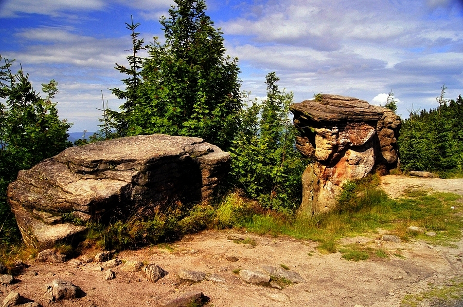
On the crest of the mountain there are very nice rocky outcrops of coarse sandstone.
The very unusual in the Polish language name of the mountain is probably of the Czech origin where the word means – a raven, so Krykavica would mean a place where the ravens live or it is a word taken from a local dialect in which ‘kirkac’ means to tousle (probably because of the tousled shape of the top of the mountain).
The top of the mountain in the main Mount Czantoria range is also the borderline between Poland and the Czech Republic.
There are several tourist routes which run from the top of Kyrkavica: the red one is a part of the main Beskid Route from the Kubalonka Pass, the yellow one is the route from Jaworzynka and the blue route is from Mount Wielki Stożek to Mount Czantoria.
How would you like to spend your time here?


Partners