Hiking trails

Bicycle trails

Walking routes

Trail of the Habsburgs

Architecture trail

Educational paths

Architectural monuments
Bicycle
Bowling
Cave
Churches
Climbing area
Discotheques
Environmental education
Exhibitions/ displays
Fitness
Historical cemeteries
Horse riding
Landscaped park
Monuments
Motor sports
Museums and galleries
Nature and extreme
Nature reserve/ ecological use
Inne/Dziedzictwo kulturowe
Inne/Rozrywka
Other sports entertainment
Paintball
Playground
Rock formation
Ropes course
Skate park
Skiing
Skiing and snowboarding
Snowboarding
Spa
Swimming pool
Tennis
Water reservoir
Wooden architecture

Koleje linowe

Accommodation

Restaurants and bars
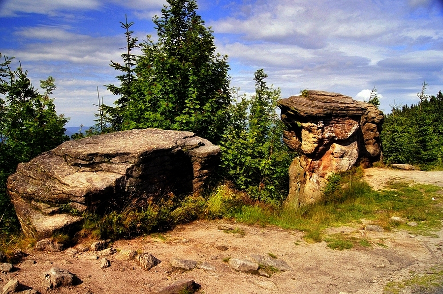
Kyrkavica (973 meters above the sea level) is a medium size mountain in the range of Mount Czantoria in the Silesian Beskid mountains between Mount Stożek and Mount Kiczora. Kyrkavica is the place where the range changes its direction from the parallel to the meridian and where a part of the range – Groniczek – lowers in the direction of Jablonków in the Olza river valley.
On the crest of the mountain there are very nice rocky outcrops of coarse sandstone.
The very unusual in the Polish language name of the mountain is probably of the Czech origin where the word means – a raven, so Krykavica would mean a place where the ravens live or it is a word taken from a local dialect in which ‘kirkac’ means to tousle (probably because of the tousled shape of the top of the mountain).
The top of the mountain in the main Mount Czantoria range is also the borderline between Poland and the Czech Republic.
There are several tourist routes which run from the top of Kyrkavica: the red one is a part of the main Beskid Route from the Kubalonka Pass, the yellow one is the route from Jaworzynka and the blue route is from Mount Wielki Stożek to Mount Czantoria.
How would you like to spend your time here?


Partners