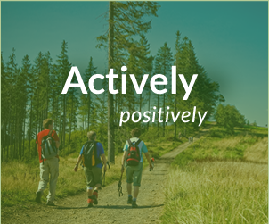
Educational – nature path on Mount Barania
st. Czarna Wisełka
Location: Czarne
Czarna Wisełka Road
The educational – nature path on Mount Barania is situated in the area on and around the top of the mountain. It runs along the valley of the Black Vistula River to the top of Mount Barania and then back along the valley of the White Vistula River. Altogether the path is about 16 kilometers long and it may take up to 8 hours to walk it (an experienced walker can cover the distance much faster). The difference in elevation is about 650 meters.
There are 25 information boards along the path, they are arranged every few hundred meters. Most of the path runs along the two valleys which are both protected nature reserves while the upper part of the path (above 950 meters above the sea level) runs through the nature reserve ‘Barania Góra‘.
The path starts at the forester’s lodge in Wisła Czarne near the forestry which has been recently renovated after the devastating winds of the 90s. The second stop is at the seed stand and the third one is a 93 year old fir stand with an area of about 90 hectares. The fourth stop is at a natural spring and the fifth at Bujokowa Kolnia a place where an old shed used to stand. Then the path runs through a 150 year old tree stand –stop number six, a viewpoint - stop number seven and to another natural spring called Cygonka – stop number eight. The name of the spring comes from a small hut where, before the war, an old Gypsy woman used to live. Next to the stop there is a resting area for the tourists and a pasture for wild animals. Stop number nine is the place where the Black Vistula River meets one of its tributes, a small stream Ciepła (means warm – it never freezes, even in winter). Then the path turns towards Stecówka – a little village near Istebna. The next stop is another resting area for the tourists at the wood gathering point and the place where another stream – Wolna joins the Black Vistula River.
The next two stops are in a large meadow – Przysłop, next to the tourist shelter. Stop number 11 is at a Forest Chamber in an old Forester’s Lodge from 1863 (with a rich exhibition of fauna and flora of the region and a room which imitates an original forester’s office), stop number 12 is the Museum of Tourism ‘U Źródeł Wisły’ (a small house from 1951 with an exhibition of history of mountain tourism in the Beskid Mountains). Stop number 13 is the Przysłop meadow with a magnificent view of all the Silesian Beskid Mountains. That is the place where the path enters the area of the nature reserve ‘Barania Góra’.
Most of the path running from the meadow to the top of Mount Barania goes through a forest – Mysia Polana (stop number 14 is the place where the tourist route meets a ski slope), Wyrch Wisełka (stop number 15 with another shed for the tourists in case of bad weather), the top of the mountain is stop number 16 with an observation tower and a fantastic panorama of the mountains around. The top of Mount Barania is also the borderline between Silesia and Malopolska (the eastern slope of the mountain is in Malopolska District).
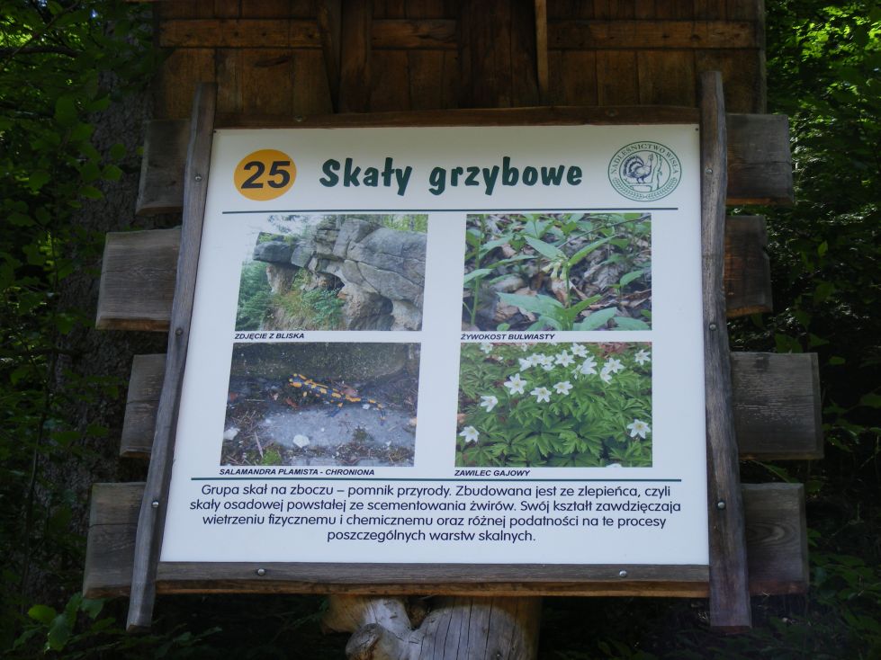
The second half of the path starts at a spruce stand (Czerwony Usyp – a spruce forest with trees 180 years old). The forest where stop number 19 is situated is even older – 200 years but it is slowly disintegrating. From stop number 20 (where we leave the nature reserve Barania Góra) the path runs along the valley of the White Vistula river, through Trzebież (stop number 21 – a young, 70 year old forest) to stop number 22 where you can see Kaskady Rodła – one of the most beautiful water thresholds in the Beskid Mountains. The next stop is at a rock outcroppings – Białka where some charcoal used to be made in the past. The last stop is near the mushroom rock formation and the path ends its way at a watchtower of the border guards in Wisła Czarne.
From Wisła Czarne to Przysłop meadow the path follows the black tourist route, between stops number 10 and 11 another route – the red one from Kubalonka Pass – joins the path. There are three routes to choose from on the path from Przysłop meadow to the top of the mountain (red, blue and green) plus the black route from Kamesznica which joins the path at stop number 15. The part of the path which runs along the valley of the White Vistula river is a part of the blue tourist route.
You can get the guidebook of the whole path at the Wisła Forest Superintendence (a little below the dam in Czarne) or at the Forest Office at the beginning of the path.
How would you like to spend your time here?


Partners